Hadrian's Wall Path Map Booklet :1:25,000 OS Route Mapping
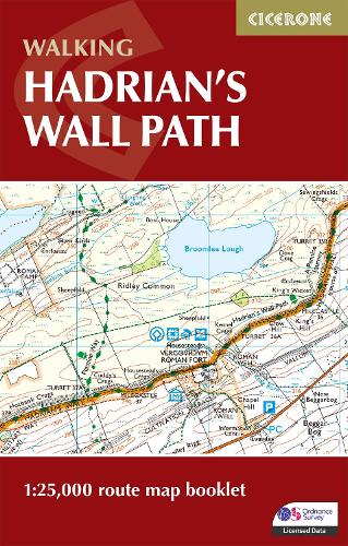
Hadrian's Wall Path Map Booklet :1:25,000 OS Route Mapping
paperback
Published:
4 August, 2023
Popular Books by Mark Richards
View All Books by Mark Richards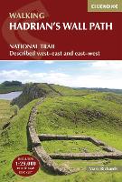


Description
All the mapping you need to walk the Hadrian’s Wall National Trail between Bowness-on-Solway in Cumbria and Wallsend, Newcastle. Covering 135km (84 miles), this historic route takes around 10 days to hike. Suitable for beginners, it nevertheless requires a reasonable level of fitness to undertake as a multi-day walk.
- The full route line is shown on 1:25,000 OS maps
- The map booklet can be used to walk the trail in either direction
- Sized to easily fit in a jacket pocket
- 2-stage route extension through Newcastle to South Shields on the east coast is also shown
- A separate Cicerone guidebook – Walking Hadrian’s Wall Path – is also available, which includes a copy of this map booklet
More Details
| Type | Book |
|---|---|
| ISBN13 | 9781786311511 |
| ISBN10 | 1786311518 |
| Number Of Pages | 56 |
| Item Weight | 60 g |
| Product Dimensions | 106 x 166 x 5 mm |
| Publisher / Reseller | Cicerone Press |
| Format | paperback |
| Edition | 2nd Revised edition |
Author's Bio
In 1980 Mark Richards began his three-part guide to the Peak District for Cicerone Press, and in 1987, with Chris Wright, wrote a guide to walking around the former county of Westmorland. He now lives in Cumbria and, after 14 years' dedicated research, has completed his series of Lakeland Fellranger guides covering the entire region. Mark lives close to Hadrian's Wall, enabling him to renew a fascination kindled when he first prepared a guide to walking the Wall in 1991.