Bristol and Bath A-Z Street Atlas
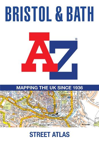
Bristol and Bath A-Z Street Atlas
paperback
Published:
21 May, 2026

Popular Books by A-Z Maps
View All Books by A-Z Maps

Description
Printed in full-colour, paperback format, this atlas contains 96 pages of continuous street mapping. Large scale 4 inches to 1 mile map.
Areas covered include: Olvestone, Avonmouth, Patchway, Kingswood, Keynsham, Dundry, Frampton Cotterall, and Bradford-on-Avon.
Also included are large scale city centre maps of both Bristol and Bath.
A comprehensive index lists streets, selected flats, walkways and places of interest, place, area and station names. Additional healthcare (hospitals, walk-in centres and hospices) and transport connections are indexed as well.
More Details
| Type | Book |
|---|---|
| ISBN13 | 9780008780746 |
| ISBN10 | 0008780749 |
| Number Of Pages | 144 |
| Item Weight | 270 g |
| Product Dimensions | 149 x 215 x 9 mm |
| Publisher / Reseller | HarperCollins Publishers |
| Format | paperback |
| Edition | 8th Revised edition |
Author's Bio
Britain’s leading street map publisher providing cartographic services, digital data products and paper mapping publications (including Street Atlases, Visitors Guides, Great Britain Road Atlases and The Adventure Atlas).