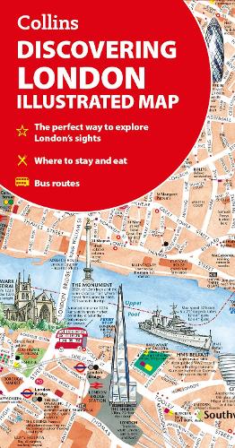
Discovering London Illustrated Map
Discovering London Illustrated Map
map
Published:
27 March, 2025
map
Published:
27 March, 2025
Standard worldwide delivery by
Fri, June 19 - Wed, June 24
Order within
0
Popular Books by Dominic Beddow
View All Books by Dominic Beddow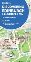
Description
A new edition of London’s most original map. This hand-watercoloured map contains individual paintings of all the main sites and landmarks, shop-by-shop street maps, theatres and cinemas, comprehensive travel information and index. This detailed map of Central London is at a scale of 1:8,250 (7.5 inches to 1 mile).
Coverage extends from Regent’s Park in the north to Battersea in the south, and from Kensington in the west to Tower Bridge in the east.
This attractive and fact-filled map would make a lovely souvenir for the visitor to London.
The map features:
- Railway stations, bus routes, London underground map, taxi ranks and car parks
- Shop-by-shop street maps for Oxford Street, Bond Street, Covent Garden, Portobello Road, King’s Road, Brompton Cross, Exmouth Market, Beauchamp Place, St. Christopher’s Place and South Molton Street, Knightsbridge, Jermyn Street and Kensington
- London’s theatres and cinemas
- Places to eat, internet cafés and good places for a picnic
- An inset map of the City of London
- Comprehensive index
- Historical and contemporary anecdotes
Other titles in the series:
- Discovering Edinburgh
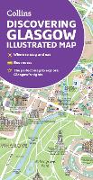
- Discovering Glasgow
More Details
| Type | Book |
|---|---|
| ISBN13 | 9780008724658 |
| ISBN10 | 0008724652 |
| Number Of Pages | 2 |
| Item Weight | 70 g |
| Product Dimensions | 102 x 198 x 6 mm |
| Publisher / Reseller | HarperCollins Publishers |
| Format | map |
See More +
Author's Bio
Explore the world through accurate and up-to-date mapping.