Portsmouth A-Z Pocket Street Map
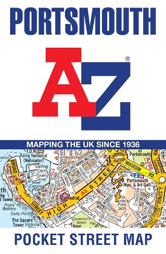
Portsmouth A-Z Pocket Street Map
map
Published:
15 April, 2021

Popular Books by A-Z Maps
View All Books by A-Z Maps


Description
This up-to-date detailed, folded A-Z street map includes more than 2000 streets in and around Portsmouth. As well as ferry routes from Portsmouth Harbour, other areas covered include Southsea, Fratton, Milton Common, Hilsea and Cosham.
The large-scale street map includes the following:
• Places of interest
• Postcode districts, one-way streets and car parks
• Index to streets, places of interest, place and area names, park and ride sites, national rail stations, hospitals and hospices
The perfect reference map for finding your way around Portsmouth.
More Details
| Type | Book |
|---|---|
| ISBN13 | 9780008445287 |
| ISBN10 | 0008445281 |
| Number Of Pages | 2 |
| Item Weight | 40 g |
| Product Dimensions | 90 x 140 x 8 mm |
| Publisher / Reseller | HarperCollins Publishers |
| Format | map |
GoodReads Reviews
Author's Bio
Britain’s leading street map publisher providing cartographic services, digital data products and paper mapping publications (including Street Atlases, Visitors Guides, Great Britain Road Atlases and The Adventure Atlas).