Vancouver Island (1:250.000)
Vancouver Island (1:250.000)
Sheet map, folded | German
Published:
12 August, 2019
Sheet map, folded | German
Published:
12 August, 2019
Standard worldwide delivery by
Thu, July 23 - Tue, July 28
Order within
0
Description
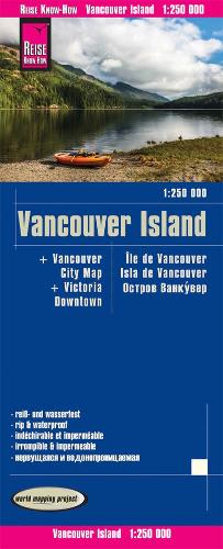
Highly tear-resistant and 100% waterproof map "Vancouver Island" from the series world mapping project, published by Reise Know-How Verlag. Travel know-how maps are characterized by particularly stable plastic paper, which is writable like paper, even with pencil. The cardboard envelope is removable, so the card can be easily inserted into any pocket. A protective cover is not required. The cartographic representation focuses on the most important information for travelers and is particularly easy to read. Instead of shading, colored height layers are used. Equipment: - Contour lines with altitude indications; - Coloured elevation layers; - Classified road network with distance indications; -Sights; - Detailed location index; - GPS-accurate; - latitude and longitude; - Five-language legend (german, English, French, Spanish, Russian); including Vancouver City map and Victoria Downtown map. Handy format: 70x100 cm, printed on 2 sides. Languages: German, English, French, Spanish, Russian
More Details
| Type | Book |
|---|---|
| ISBN13 | 9783831774258 |
| ISBN10 | 3831774250 |
| Number Of Pages | 1 |
| Item Weight | 1000 g |
| Publisher / Reseller | Reise Know-How Verlag Peter Rump GmbH |
| Format | Sheet map, folded |
See More +