Zillertal Alps, hiking, cycling and leisure map
Zillertal Alps, hiking, cycling and leisure map
map
Published:
20 November, 0816
map
Published:
20 November, 0816
Standard worldwide delivery by
Wed, June 17 - Mon, June 22
Order within
0
Description
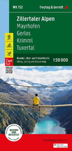
The region around Mayrhofen, Gerlos, Krimml and Tuxertal offers countless opportunities for outdoor activities, especially for hikers and cyclists. There is a well-developed network of hiking and cycling trails with different levels of difficulty and breathtaking views of the Zillertal Alps. The Zillertal Alps hiking map offers detailed information about the various hiking and cycling trails in this high alpine landscape with its many glaciers. With the hiking and cycling map, you can ideally plan your tours and find out about sights and vantage points along the route. For winter sports enthusiasts, the card offers ski routes, cross-country ski runs and all cable cars and lifts. Information on the hiking and cycling map of the Zillertal Alps Scale 1:50 000 hiking trails Bike paths Ski routes, cross-country ski trails Tourist information Rother App Waterproof and tear-resistant 82 x 60 cm
More Details
| Type | Book |
|---|---|
| ISBN13 | 9783707920550 |
| ISBN10 | 3707920550 |
| Number Of Pages | 1 |
| Item Weight | 1000 g |
| Publisher / Reseller | Freytag-Berndt |
| Format | map |
See More +