When you buy a used copy YOU SAVE
0.91Kg of CO2
114 litre(s) of Water
0.0068 Tree(s)
1 book donated to global literacy projects
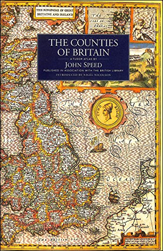
COUNTIES OF BRITAIN
COUNTIES OF BRITAIN
paperback
Published:
20 April, 1995
paperback
Published:
20 April, 1995
Standard worldwide delivery by
Tue, July 14 - Fri, July 17
Order within
0

Condition:
USED
$10.79
RRP
$19.85
You save $9.06 (46%)
Available
2
in stock
FREE Returns within 30 days
Popular Books by John Speed
View All Books by John Speed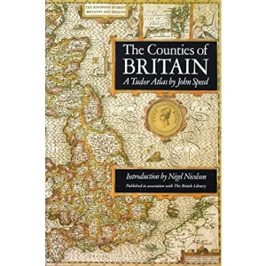
Description
This is a new edition of an atlas published in Britain in 1611 under the title The Theatre of Great Britaine . The cartographer John Speed had been preparing the individual maps since 1596 and they were issued individually before being collected to form The Theatre which was intended as the topographical section of Speed's The History of Great Britaine . When this was completed, it became the earliest published atlas of the British Isles. It was the first to show all the counties of Britain as well as towns, villages and boundaries as they were at the end of the reign of Elizabeth I and contains the first known maps of many English towns and is embellished with a wealth of heraldic decoration, illustrations of battles, antiquities and royal portraits. In his introduction, Nigel Nicolson presents a biography of Speed, outlines the craft of Tudor map-making and puts Speed's atlas into context. Alasdair Hawkyard, Archivist at Harrow School, provides captions to the individual maps, describing topographical and other aspects and enabling the reader to identify how the landscape of Britain has undergone dramatic changes during the past four centuries.
More Details
| Type | Book |
|---|---|
| ISBN13 | 9781857936124 |
| ISBN10 | 1857936124 |
| Number Of Pages | 228 |
| Item Weight | 1178 g |
| Product Dimensions | 201 x 20 x 302 mm |
| Publisher / Reseller | Pavilion Books |
| Format | paperback |
| Edition | Reprint |
See More +