Offa's Dyke Map Booklet :1:25,000 OS Route Mapping
Offa's Dyke Map Booklet :1:25,000 OS Route Mapping
paperback
Published:
19 September, 2023
Popular Books by Mike Dunn
View All Books by Mike Dunn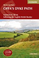


Description
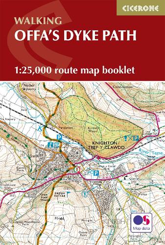
A booklet of all the mapping needed to complete Offa’s Dyke Path National Trail, following Britain’s longest ancient monument: the eighth century earthwork that once marked the boundary between the Anglo-Saxon kingdom of Mercia and the Welsh kingdoms to the east. The 285km (177 mile) route from Sedbury Cliffs near Chepstow to Prestatyn is suitable for walkers of most abilities.
- The full route line is shown on 1:25,000 OS maps
- The map booklet can be used to walk the trail in either direction
- Sized to easily fit in a jacket pocket
- The relevant extract from the OS Explorer map legend is included
- An accompanying Cicerone guidebook – Offa’s Dyke Path is also available, which includes a copy of this map booklet
More Details
| Type | Book |
|---|---|
| ISBN13 | 9781852848941 |
| ISBN10 | 1852848944 |
| Number Of Pages | 80 |
| Item Weight | 100 g |
| Product Dimensions | 116 x 172 x 5 mm |
| Publisher / Reseller | Cicerone Press |
| Format | paperback |
GoodReads Reviews
Author's Bio
Mike Dunn was born in Leicester but has lived in Penarth in the Vale of Glamorgan for over 30 years. He worked for the Welsh Assembly Government, latterly specialising in environmental and conservation issues, and has written widely on landscape, walking, pubs and real ale. Mike's favourite locations for walking are the Welsh borders, the Hebridean Islands and the Lake District.