The Snowdonia Way :A walking route through Eryri from Machynlleth to Conwy
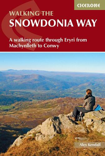
The Snowdonia Way :A walking route through Eryri from Machynlleth to Conwy
paperback
Published:
12 September, 2023
Popular Books by Alex Kendall
View All Books by Alex Kendall


Description
Discover the sparkling mountain streams, dramatic valleys, lush wooded hillsides, and expansive moorland along the Snowdonia Way, a remarkable long-distance trail winding through the heart of Eryri (Snowdonia) National Park. Spanning 156km (97 miles) from Machynlleth in the south to Conwy in the north, this iconic route leads you through a landscape steeped in history, from ancient druids and Roman invaders to the legends of King Arthur and the great Welsh princes.
Perfect for adventurous walkers able to tackle a day on rolling terrain with a backpack, this comprehensive guidebook breaks the Snowdonia Way into 6 manageable daily stages, including an alternative high-level route through the mountains. Along the way, you’ll encounter fascinating relics of the region’s industrial heritage, spot wildlife and cascading waterfalls, and enjoy welcoming pubs and cafés.
- The Snowdonia Way is described from Machynlleth in the south to Conwy in the north, with each stage featuring 1:50,000 Ordnance Survey maps to guide you confidently through the key towns, villages, and landscapes along the route.
- Stage-by-stage route descriptions lead you from the historic market town of Machynlleth, through vibrant communities such as Beddgelert and Bethesda, to the castle town of Conwy on the north coast.
- Opt for the alternative 9-stage high-level route to traverse Eryri’s most dramatic mountains, summiting iconic peaks like Cadair Idris near Dolgellau, Yr Wyddfa (Snowdon) above Llanberis, Cnicht, and the Glyders, while experiencing breathtaking views across Snowdonia’s heartland.
- Clear, step-by-step directions are supported by detailed maps and downloadable GPX files, ensuring easy navigation whether you’re crossing open moorland above Machynlleth or descending to the coastal walls of Conwy, using either GPS devices or smartphone apps.
- Each stage provides distance, walking time, ascent, terrain summary, and highlights of the route, helping you plan every step from Machynlleth to Conwy and the villages and valleys in between.
- Detailed 1:50,000 Ordnance Survey maps offer precise navigation on every stage, whether you’re navigating the foothills above Dolgellau, the wooded valleys near Beddgelert, or the open ridges leading to Conwy.
- Each stage lists refreshment stops and accommodation options in welcoming towns and villages along the way, including Machynlleth, Dolgellau, Beddgelert, Bethesda, and the historic walled town of Conwy, so you can rest and refuel throughout your adventure.
Plan your Snowdonia Way adventure with confidence and experience the best of the Eryri (Snowdonia) National Park with this definitive guidebook to one of Wales’ finest long-distance walks.
More Details
| Type | Book |
|---|---|
| ISBN13 | 9781852848569 |
| ISBN10 | 1852848561 |
| Number Of Pages | 176 |
| Item Weight | 230 g |
| Product Dimensions | 116 x 172 x 11 mm |
| Publisher / Reseller | Cicerone Press |
| Format | paperback |
GoodReads Reviews
Author's Bio
Alex Kendall is a mountain leader, working in summer and winter throughout the UK and abroad, leading groups on day walks, challenges and long distance journeys. He enjoys getting people into the outdoors, especially through supervising Duke of Edinburgh's Award expeditions and running weekend walking trips for adults. He has been walking in Eryri (Snowdonia) for over 10 years having been introduced to these mountains as a student.