Bristol in 1480 :A Medieval Merchant City
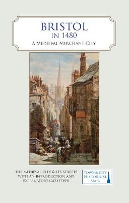
Bristol in 1480 :A Medieval Merchant City
map
Published:
28 January, 2021
map
Published:
28 January, 2021

Standard worldwide delivery by
Mon, July 20 - Thu, July 23
Order within
0
Popular Books by Helen Fulton
View All Books by Helen Fulton
Description
A full colour map, where the city in about 1480 is shown against a background of a detailed Ordnance Survey of the early 20th century. In 1480, a high-ranking official called William Worcestre revisited his native city of Bristol and wrote a detailed description of all the streets and their buildings and the activities that went on there. Worcestre’s description, combined with archaeological information and historical research, has allowed the recreation in map form of the city at that time. It was a prosperous and growing city, already trading extensively with Europe and poised to start a new trade with the Americas. Its merchant houses, churches and largely vanished city walls show a town that was easily one of the top five in England in the late Middle Ages. The map’s cover has a short introduction to the city in 1480 and an explanation of who William Worcestre was. On the reverse is an illustrated and comprehensive gazetteer of Bristol’s main sites of medieval interest. Produced in association with the University of Bristol.
More Details
| Type | Book |
|---|---|
| ISBN13 | 9780993469879 |
| ISBN10 | 0993469876 |
| Number Of Pages | 2 |
| Item Weight | 1000 g |
| Publisher / Reseller | The Historic Towns Trust |
| Format | map |
See More +