Nicholson Inland Waterways Map of Great Britain :For Everyone with an Interest in Britain’s Canals and Rivers - Nicholson Waterways Guides
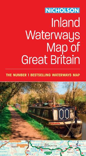
Nicholson Inland Waterways Map of Great Britain :For Everyone with an Interest in Britain’s Canals and Rivers - Nicholson Waterways Guides
map
Published:
15 February, 2024

Popular Books by Nicholson Waterways Guides
View All Books by Nicholson Waterways Guides


Description
The best-selling guides to Britain’s canals and rivers for more than 50 years.
The map companion to the Collins Nicholson Waterways Guides, covering the entire network of canal and river navigations in England, Scotland and Wales, including newly restored/opened canals and rivers.
The map identifies:
• narrow and broad canals
• navigable rivers
• tidal river navigations
• waterways under construction
Also:
• contact telephone numbers and dimensions for each waterway
• internet links
Clear insets of the Birmingham Canal Navigations, Scottish inland waterways, the Norfolk Broads and the London area.
More Details
| Type | Book |
|---|---|
| ISBN13 | 9780008652876 |
| ISBN10 | 0008652872 |
| Number Of Pages | 1 |
| Item Weight | 130 g |
| Product Dimensions | 127 x 238 x 10 mm |
| Publisher / Reseller | HarperCollins Publishers |
| Format | map |
Media Reviews
"Taste in guide books can be a very personal thing, but few serious boaters will venture out without a Nicholson's Guide. There is a wealth of information that even the most experienced cannot hope to keep abreast of, and the guides are welcome valuable for cyclists and walkers too." The Inland Waterways Association.
Author's Bio
Explore the world through accurate and up-to-date mapping.