UK in Maps :Explore the Uk – Past, Present and Future - Collins Primary Atlases
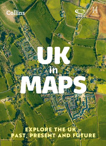
UK in Maps :Explore the Uk – Past, Present and Future - Collins Primary Atlases
paperback
Published:
2 March, 2023
Popular Books by Stephen Scoffham
View All Books by Stephen Scoffham


Description
Bring geography, history and the environment together with this thematic UK atlas suitable for Key Stage 2 and lower Key Stage 3.
Fully up-to-date and endorsed by the Geographical and Historical Associations, it helps children to understand how things came to be, as well as how they might change in years to come.
UK in Maps investigates themes with a focus on environmental issues, energy, transport, farming and tourism and includes reference maps for all the different regions of the UK.
Ideal for classroom use and home learning, it provides opportunities for pupils to conduct their own enquiries and explore maths in context using maps, satellite images, diagrams, charts and photographs.
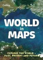
Also available: World in Maps ISBN 9780008556471
More Details
| Type | Book |
|---|---|
| ISBN13 | 9780008556488 |
| ISBN10 | 0008556482 |
| Number Of Pages | 56 |
| Item Weight | 240 g |
| Product Dimensions | 226 x 312 x 4 mm |
| Publisher / Reseller | HarperCollins Publishers |
| Format | paperback |
| Edition | 3rd Revised edition |
GoodReads Reviews
Author's Bio
Dr Stephen Scoffham is a Visiting Reader in Sustainability and Education at Canterbury Christ Church University. He is the author of many texts for children and teachers on primary geography and has won awards from the Geographical Association for his publications for the past two years running (2014 and 2015). Stephen has been an elected member of the Geographical Association’s governing body since 2011.