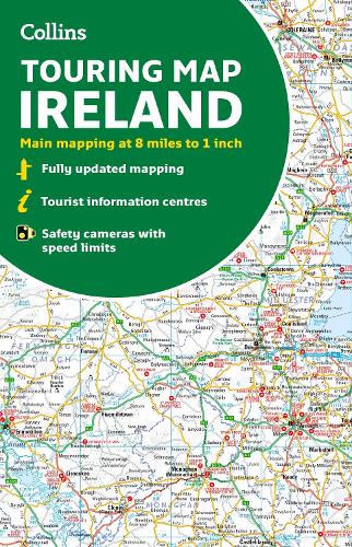
Collins Ireland Touring Map
Collins Ireland Touring Map
map
Published:
17 March, 2022
Popular Books by Collins Maps
View All Books by Collins Maps


Description
Explore new places with handy pocket maps from Collins.
Large full colour map of the whole of Ireland showing the road network in detail, and with a special emphasis on places of tourist interest.
This map has a handy touring scale of 7.5 miles to 1 inch (1:475,200). It has more than 20 categories of tourist information depicted clearly on the map. There is a full index to place names and places of interest.
This map includes:
• All classified and most minor roads
• Railway network and ferry routes
• Viewpoints and sandy beaches
• Speed enforcement zones and safety camera locations
• Index to 20 categories of tourist information
• Includes castles, historic houses, gardens, beaches and golf courses
More Details
| Type | Book |
|---|---|
| ISBN13 | 9780008369965 |
| ISBN10 | 0008369968 |
| Number Of Pages | 1 |
| Item Weight | 140 g |
| Product Dimensions | 139 x 237 x 9 mm |
| Publisher / Reseller | HarperCollins Publishers |
| Format | map |
GoodReads Reviews
Author's Bio
Explore the world through accurate and up-to-date mapping.